ARY Engineering Aerial Drone Services
2D Aerial Drone Mapping
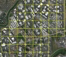
Conduct aerial surveys and create high definition orthomosaic maps of your facility, stitched from thousands of pictures and LIDAR data by ARY’s drafting and design team, utilizing our industry-grade aerial drone services.
Daily and weekly recurring maps, which can be collected by regular drone surveys, are often used to manage stockpiles, water drainage, erosion detection, and pit and dump management, among a variety of other uses.
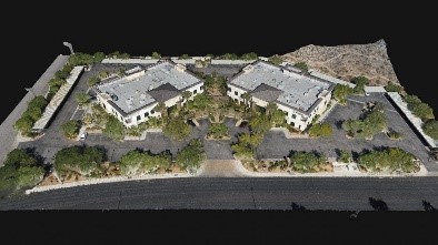
3D Aerial Drone Modeling
Creating a 3D snapshot of an environment with ARY’s advanced point cloud meshing technology allows your team to navigate a 3D model of the site remotely. Unlike traditional on-site survey data, ARY’s aerial drone services provide a vastly superior level of detail and accuracy, for a fraction of the cost and time required.
In fact, a study commissioned by the Journal of Big Data found that a well-structured tri-altitude scan can deliver results with an accuracy rate of up to 98.68%,
Multispectral Drone Crop Analysis
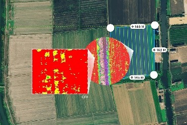
Analyze your crop’s health and improve your yield using ARY’s multispectral imaging technology, allowing you to:
- Identify pests, disease, and weeds
- Provide data on soil fertility and refine fertilization by detecting nutrient deficiencies
- Measure irrigation insufficiencies and analyze potential water stress
Aerial Multispectral Crop Analysis
Conduct visual inspections of assets in hard-to-reach areas, cutting down on the risk and expense of exposing people to dangerous environments.
Our camera’s ability to swivel 180 degrees allows you to inspect the undersides of structures such as bridges, giving you an unprecedented opportunity for up-close analysis, without endangering your team.
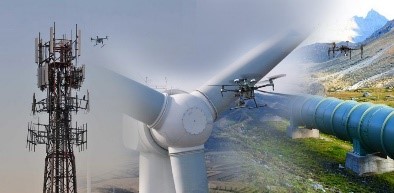
Thermal Aerial Inspection Capabilities
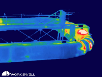
Aerial drone services that include thermal infrared inspections can help you spot heat leakage, water damaged areas, and collect valuable data for repairs.
Inspect substations and outdoor electrical facilities, uncovering areas with excess heat and preventing component failures.
Streamline your pipeline’s ROI by identifying thermal and pressure leaks with aerial drone services, which are nearly impossible to efficiently identify manually with an on-ground team.